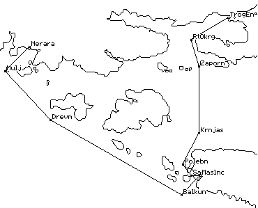
RealMaps can show points and lines on maps which represent waypoints and routes.
|
Overlays
for RealMaps RealMaps can show points and lines on maps which represent waypoints and routes. |
The data used is held in simple
"overlay" text files. GarmEdit can now generate these
files directly from waypoint files. For routes it is suggested
that you display the waypoints in route order by viewing
waypoints in the current route using "Filter" (Cntrl-Shift-F)
in GarmEdit and then write them to an overlay file for RealMaps
to read.
Please send any comments to Mike at work or Mike at home.