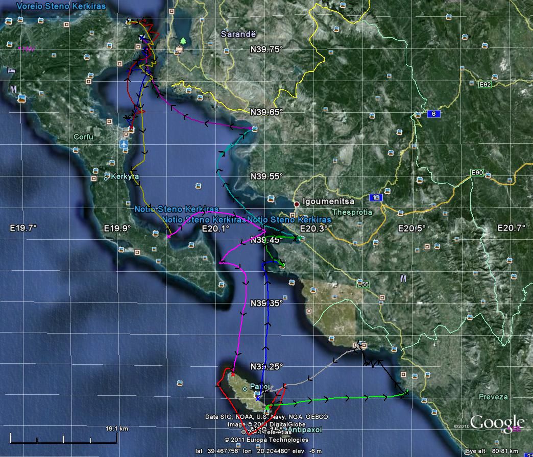
Corfu area, Greece, June/July 2011
For this trip we had a 36 foot yacht for the four of us. The flotilla was intended to visit, and is named after, the “Faraway Islands” to the north-west of Corfu. But the harbours there are not sheltered from southerly winds, which were forecast for our visit, so that part of the itinerary was cancelled. That is why the islands do not appear in the Google Earth picture above.
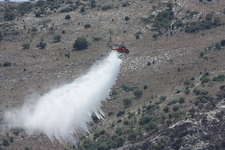
We also missed a day's sailing at the start of the trip because of the weather. That gave rise to the opportunity to snap a seaplane and then a helicopter putting out a scrub fire near the harbour (see below).
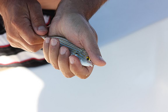
Nick is a keen fisherman, so when the flotilla leaders announced a fishing competition he dashed out and bought a telescopic rod and bait. The photo below records his entry in the category “prettiest fish”!
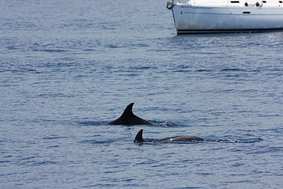
Finally, on our last day the VHF was buzzing with news of a pod of dolphins just outside the bay. So with several other yachts we lingered amongst this pod. Nick dived off the yacht, and though the dolphins did not come close (they appeared to have young with them) he could easily hear their underwater communication sounds.
Google Earth “KMZ” file: Full track (23Kb zipped)
Note that the Google Earth track does not include the 30-minute marker arrows that are just visible in the picture above (and more so on the linked full size screen-shot). But the lines are differently coloured in a rainbow(-ish; brown, red, orange, yellow, green, blue, violet) sequence so it is easier to see the successive days. The actual date and (GMT) start time of each track is visible if you expand the path.
Below are some photos taken during this trip. Hover over each for an explanation or click for a (much) larger version. Additional photos are at Picasa.
Back to the list of my yachting trips.