GREECE
June, 1999

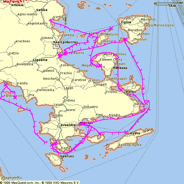
I downloaded the base map of the Peloponnese from MapQuest's website.
The tracks were drawn onto the bitmap using
GPS Utility.
GPS Utility lets me annotate the tracks; I chose a "tick" for each 20 minutes of sailing time.
The quality in this image has been degraded by scaling to fit the page; to see a full size one click on the image (30Kb rather than 26Kb).

Google Earth KMZ” file: Full track (20Kb zipped)

Note that the Google Earth track does not include the 20-minute markers that are just visible in the picture above (and more so on the linked full size screen-shot). But the lines are differently coloured in a rainbow(-ish; brown, red, orange, yellow, green, blue, violet) sequence so it is easier to see the successive days. The actual date and (GMT) start time of each track is visible if you expand the path.

Back to the list of my yachting trips.